The all-sky imager produces the images seen below, where the red (630.0nm) and blue (427.8nm) exposures are to the left and right respectively. The top of the image points poleward, the bottom equatorward. The auroral oval is clearly seen by the white band extending to a magnetic latitude of ~70 degrees.
Monochromatic all-sky imagers are a powerful tool for observing and monitoring the optical aurora. The PENGUIn all-sky imagers are being used to:
- Determine the polar cap auroral morphology under varied IMF conditions, solar wind pressure and internal magnetospheric conditions.
- Compare auroral dynamics to ionospheric plasma convection and magnetic variations
- Compare the optical aurora observed from the ground with satellite based observations.


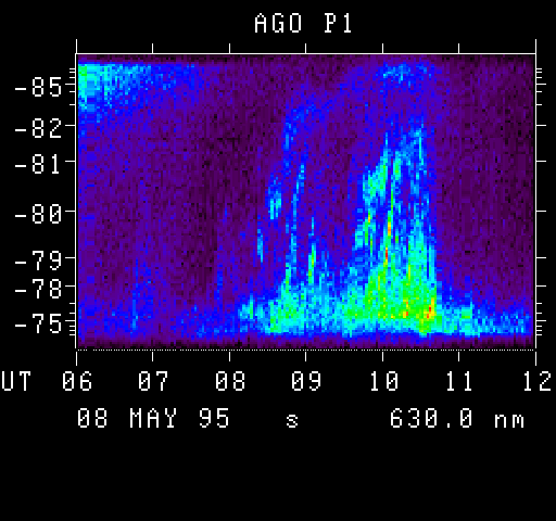
Keograms are obtained by extracting pixels from the all-sky image either north-south along the magnetic meridian or east-west. These pixels are plotted from progressive images creating both latitude vs. time and longitude vs. time plots. The location of the keogram strip in the raw image is seen above.
The station name (P1) is given on top and the date, long or short exposure, and wavelength of monochromatic observation are given at the bottom. Poleward moving auroral forms are seen to occur just after 8:00 UT. Magnetic noon occurs at 15:30 UT at P1 station.
Keograms are a convenient way to browse large amounts of data. Summary plots of all-sky keograms are made public for scientific use. Due to the remote location and unmanned operation gaps in data are seen due to instrument failure, sun illumination and full moon periods.